











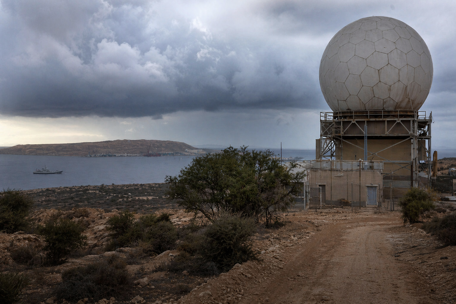
Radar strikes in the Gulf, shifting rainfall across the Middle East (Persian Gulf) basin, and a growing chain of surveillance installations from Arabia to East Africa are converging into one of the most unusual cross-regional investigations now emerging between West Asia and the Horn.
Lead: the incident that reopened an old question
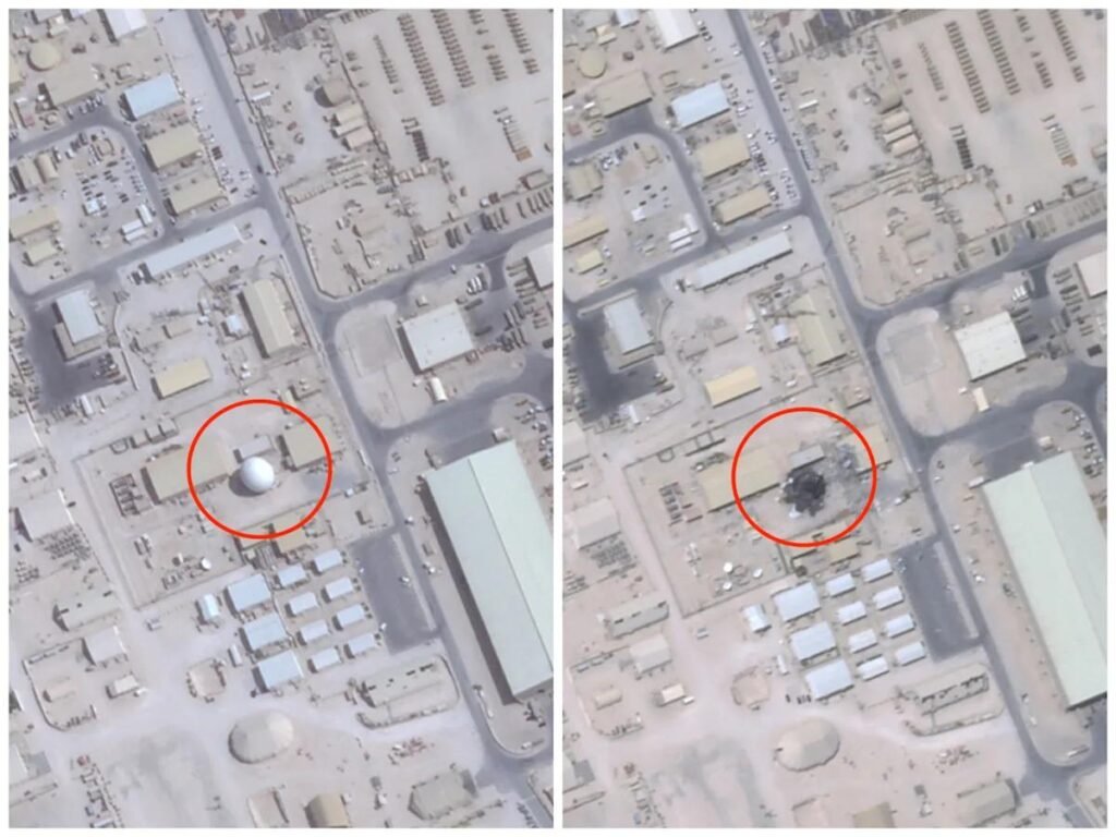
Roughly forty days after Iranian strikes reportedly damaged several high-value U.S. radar installations across the Gulf, unusually persistent rainfall began appearing across parts of the Persian Gulf corridor. The timing did not go unnoticed. Analysts in parts of Iran and the wider Middle East began asking whether the destruction of long-range monitoring systems might reveal a deeper infrastructure layer spanning the Arabian Peninsula to Somalia—a corridor where seasonal rainfall has become increasingly unpredictable over the past two decades. What exactly were those installations tracking?
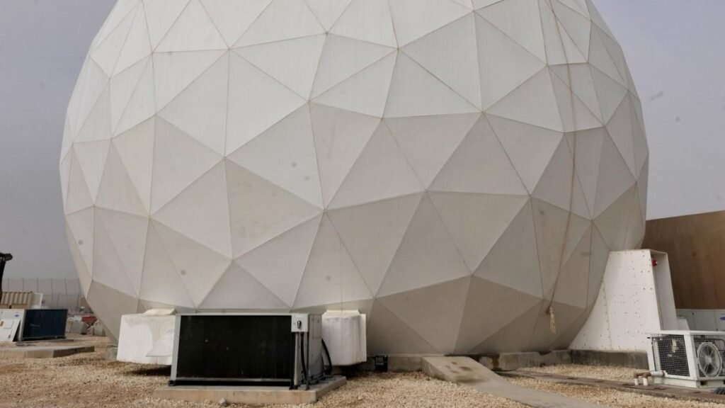
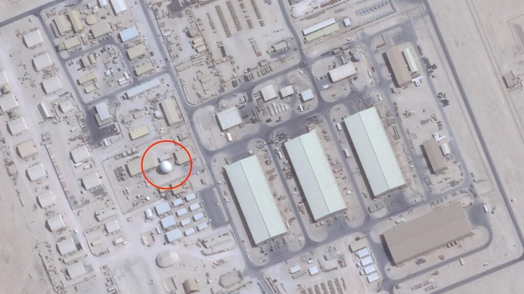
The inquiry quickly expanded beyond the Gulf itself. Attention turned toward a broader surveillance arc stretching across the Red Sea and into Somalia—a region where rainfall patterns have become increasingly unstable over the past two decades.
What began as a battlefield assessment is now evolving into a corridor-scale environmental investigation.
A surveillance chain across one of the world’s narrowest maritime gateways
The Bab el-Mandeb Strait links the Mediterranean trade system to the Indian Ocean energy corridor. Nearly 6 million barrels of oil per day pass through this chokepoint.
It is also one of the most intensively monitored air-maritime corridors outside Europe and East Asia.
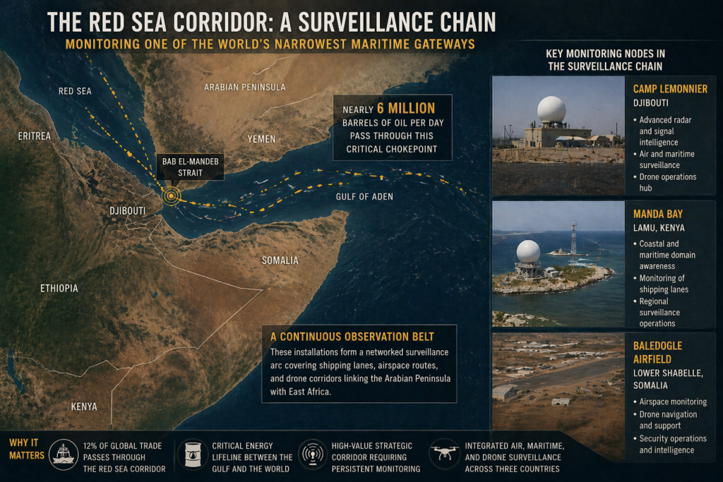
Key monitoring nodes frequently referenced in regional mapping include:
- Camp Lemonnier
- Manda Bay
- Baledogle Airfield
Together, they support persistent surveillance across shipping lanes, airspace routes, and drone navigation corridors linking the Arabian Peninsula with East Africa.
Over the past two decades, these installations formed what some analysts now describe as a continuous observation belt spanning arid climate zones from the Gulf to the Horn.
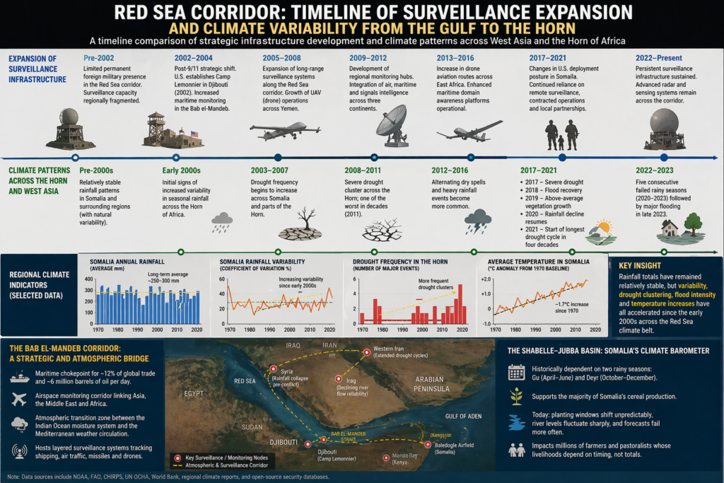
The timeline overlap investigators are studying
The emerging investigation does not begin with Somalia’s climate record alone.
Instead, it begins with a timeline comparison:
After 2002
- expansion of long-range surveillance infrastructure along the Red Sea corridor
- establishment of permanent monitoring hubs in Djibouti
- growth of drone aviation routes across Yemen and East Africa
After the early 2000s
- rainfall variability increased across Somalia
- drought clustering intensified across the Horn
- flood reversals began occurring more frequently after dry cycles
The overlap between these timelines is now being examined as a potential research question rather than a conclusion.
Somalia’s rainfall totals stayed stable—but its seasons changed
Somalia receives approximately 250–300 mm of rainfall annually.
That number has not collapsed.
What changed instead was predictability.
Since the early 2000s:
- drought intervals shortened
- recovery seasons weakened
- flood intensity increased
- rainfall onset shifted unpredictably
Between 2020 and 2023, Somalia experienced five consecutive failed rainy seasons, the longest sequence in four decades.
Within months, major flooding followed along the Shabelle and Jubba river systems.
Researchers now describe this pattern as oscillating climate instability rather than gradual drying.
The Shabelle–Jubba basin: Somalia’s climate barometer
Southern Somalia provides one of the clearest indicators of rainfall timing change in the Horn of Africa.
Historically dependent on two seasonal cycles:
- Gu (April–June)
- Deyr (October–December)
the basin supported the majority of Somalia’s cereal production.
Today:
planting windows shift unpredictably
river levels fluctuate sharply
seasonal forecasts fail more often
The change affects millions of farmers whose livelihoods depend not on rainfall volume—but rainfall timing.
Similar patterns appear elsewhere along the corridor
Somalia is not the only region experiencing rainfall instability across the Red Sea climate belt.
Across the same decades:
western Iran recorded extended drought cycles
river systems in Iraq showed declining flow reliability
agricultural zones in Syria experienced rainfall collapse prior to conflict escalation
Each lies within the same atmospheric transition zone linking the Indian Ocean moisture system to Mediterranean weather circulation.
Investigators are increasingly examining these regions together rather than separately.
The Bab el-Mandeb corridor as both logistics route and observation zone
The Bab el-Mandeb Strait is often described as a maritime chokepoint.
Less frequently discussed is its role as an airspace monitoring corridor linking multiple surveillance platforms across three continents.
From Djibouti’s coastline to Yemen’s western escarpment, layered monitoring systems track:
commercial shipping
missile trajectories
drone movement
regional airspace activity
Within emerging analytical discussions, this corridor is now also being examined as an atmospheric transition zone connecting West Asian and East African climate systems.
The withdrawal years that raised new questions
Between 2017 and 2021, during shifts in U.S. deployment posture inside Somalia, rainfall patterns followed a striking sequence:
2017 — severe drought
2018 — flood recovery
2019 — above-average vegetation growth
2020 — rainfall decline resumes
2021 — start of the longest drought cycle in four decades
Researchers studying corridor-scale climate variability consider this period a data point within a longer timeline stretching back to the early 2000s rather than an isolated event.
Temperature increases amplified seasonal stress
Somalia’s average temperature has increased by approximately 1.7 °C since 1970.
Even where rainfall totals remain stable, higher evaporation reduces soil moisture retention and intensifies drought severity.
This interaction between warming and rainfall timing change complicates efforts to interpret climate signals across the Horn.
Why the Gulf radar strikes changed the conversation
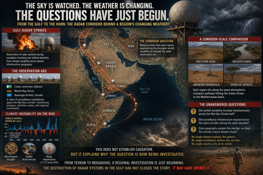
The destruction of radar systems during escalation involving Iran shifted attention from climate variability alone toward infrastructure geography.
Analysts began mapping where major surveillance systems operate across the Red Sea corridor.
That mapping produced an unexpected observation:
many of the regions experiencing the strongest rainfall instability lie beneath the same observation arc.
This does not establish causation.
But it explains why the question is now being investigated.
A corridor-scale comparison now underway
Rather than examining individual countries separately, analysts are increasingly comparing rainfall variability across:
western Iran
Mesopotamia
the Arabian Peninsula
the Horn of Africa
Each sits along the same atmospheric transport pathway linking the Indian Ocean to the Mediterranean basin.
The unanswered questions shaping the investigation
No single dataset explains the pattern.
No single installation defines the corridor.
And no single country sits at its center.
Instead, researchers are asking:
Did rainfall variability increase simultaneously across the Red Sea climate belt?
Did surveillance infrastructure expand across the same corridor during the same decades?
Does geography explain the overlap—or does the overlap require deeper study?
These questions remain open.
A regional investigation just beginning
From Tehran to Mogadishu, analysts are now examining whether the Red Sea–Arabian surveillance corridor coincides with zones experiencing some of the fastest changes in seasonal rainfall predictability anywhere in the Global South.
For now, the destruction of radar systems in the Gulf has not closed the story.
It may have opened it.
















Leave a comment